
Flood Damage Assessment: Ventura River Preserve
Report Date: January 18, 2023
Want to know which trails are open? Please visit ovlc.org/trails
The assessment of damages to trails and infrastructure at Ventura River Preserve has been completed. The following report provides a brief summary of our reconnaissance.
Trail damage at the Ventura River Preserve is substantial. Our initial damage assessment has resulted in over 50 problem spots that are directly attributable to the storm. Trail damages include blowouts, slides, significant erosion, and in some areas of the floodplain the trails are completely gone. A few key points:
Riverview and Oso Trailheads remain connected to each other by trails on the east side of the river, but they are no longer connected to the Old Baldwin Trailhead.
All of the trails that used to cross the river no longer exist, and it is still hazardous to cross the Ventura River.
There is currently no access to the trails west of the river such as Rice Canyon, Wills Canyon, and Oso Ridge, and the trails sustained substantial damage.
All trails west of the river are closed to all users.
Starting 1/21/23 all three trailheads and the Lower and Upper River Bottom Loop Trails are open for all users. Thank you for your patience as we work to reopen access to the land you love.

Oso Trailhead
There are some sections of the Upper and Lower River Bottom Trails that sustained only minimal damaged, however they no longer connect to Old Baldwin Trailhead. Rather, the river now flows where trails once stood. Please note that it is currently not safe to cross the Ventura River at Oso Trailhead, or anywhere else. Below shows a before and after of the Ventura River crossing at Oso Trailhead. The image taken on January 5 was taken after the first storm we received. The second image was taken after the big storm that occurred five days later. Note how much vegetation was wiped out. All trails across the river will remain closed, even as the river's water levels subside, until we repair the hazards and damages on the other side.


Image Left: Ventura River crossing at Oso Trailhead taken on January 5, 2023 (after the first storm)
Image Right: Ventura River crossing at Oso Trailhead taken on January 5, 2023 (after the first storm)

The Ventura River at the Oso Trailhead days after the storm. It is beautiful, but still hazardous.
Swimming Hole
The swimming hole at the Ventura River Preserve has been filled in with sediment and river rock. This all happened naturally due to the storm. We did not, nor have we ever, filled in the swimming hole.

Aerial drone imagery of the Ventura River taken by Wade Sedgwick
Along with the swimming hole filling in, access to the swimming hole has been cutoff. The trail is completely gone where the trail splits off from the Upper River Bottom Loop to head towards the swimming hole. Users will now be met with a 10 foot drop off, and currently, a raging river.

The old trail to the swimming hole ends in a dangerous 10 foot drop, into a raging river.
We invite you to watch the video below as Director of Field Programs, Brendan Taylor describes the hazards at this section of trail.
Lower River Bottom Loop
From the south end of the Upper River Bottom Loop to the northern end of the Lower River Bottom Loop, the river took its natural course and significantly altered the landscape and the trails. The first set of images below shows before and after images of the trail in March 2022 vs January 2023. The trail is indeed one with the river today.


Image Left: A section of the River Bottom Loop Trail taken in March 2022
Image Right: The same section of the River Bottom Loop Trail taken in January 2023


Image Left: Where Cozy Dell Creek meets the Ventura River
Image Right: The same section of the River Bottom Loop Trail taken in January 2023
Pictured below is the west and east sides of lower Wills crossing. The crossing has been wiped out and the river nearly wiped out our signage too.


Riverview Trailhead
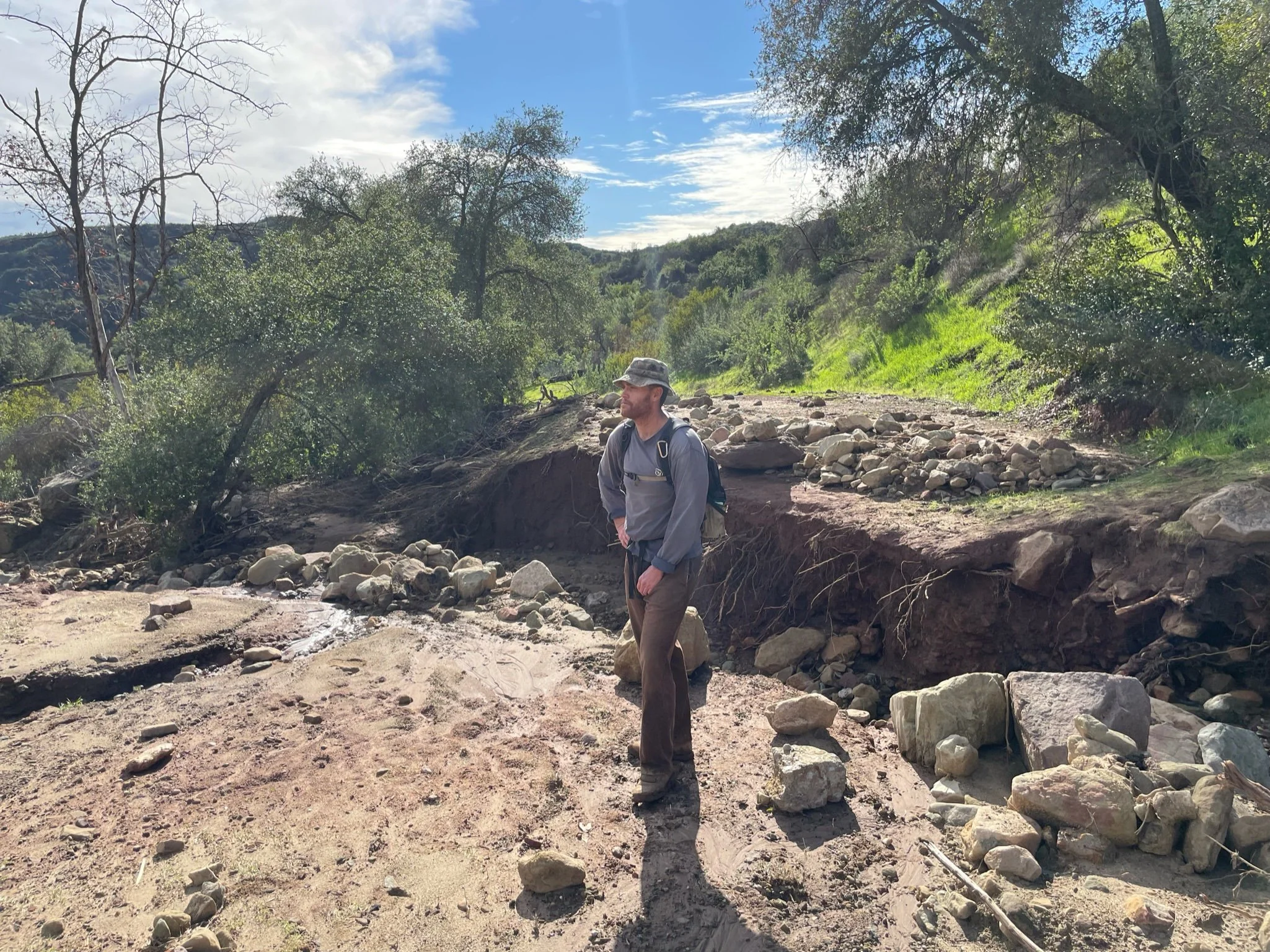
To date, Cozy Dell Creek (pictured below) is still running. While it is possible to cross safely, it cannot be accomplished without getting wet in shin-deep water.

West junction of Wills Crossover Trail. Courtesy of Wade Sedgwick
Rice Canyon
A portion of Rice Canyon on Forest Service land has suffered a major blowout. An unnamed creek naturally flows through this portion of the road. In 2019, this same spot blew out, however, this time the damage this time is much more. The third image below depicts a before and after photo of former OVLC Restoration Team Member, Niko Georghiou photoshopped into this year's damage for scale.


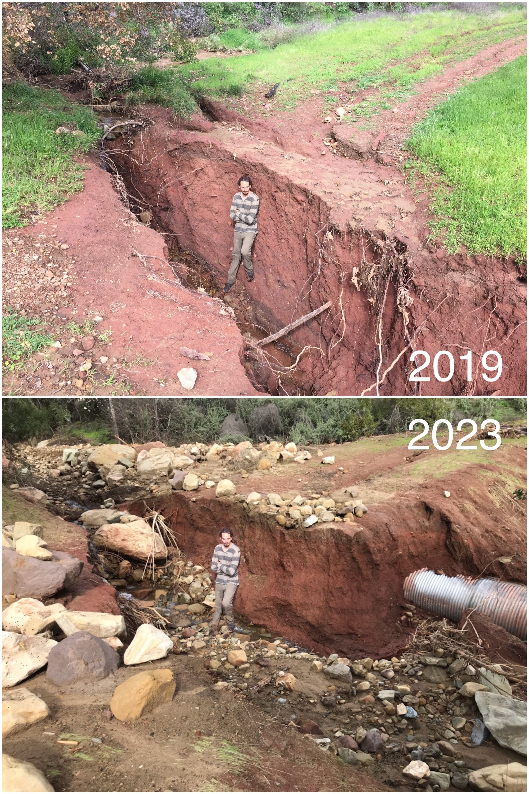
Director of Field Programs, Brendan Taylor on the scene for scale. Rocks were moving, folks!

Wills Canyon
The creek in Wills Canyon is flowing nicely and the trail faired well in the storm. There are instances where crossings will need to be cleared, and there are a few downed trees to be removed. Unfortunately, at the mouth of Wills Canyon, the western-most section of the West River Trail was completely wiped out.


Image Left: Junction of Rice Canyon and El Nido Meadow
Image Right: Creek crossing in Wills Canyon


Image Left: Downed oak tree across Wills Canyon Trail
Image Right Wills to West River Trail Connector
Oso Ridge
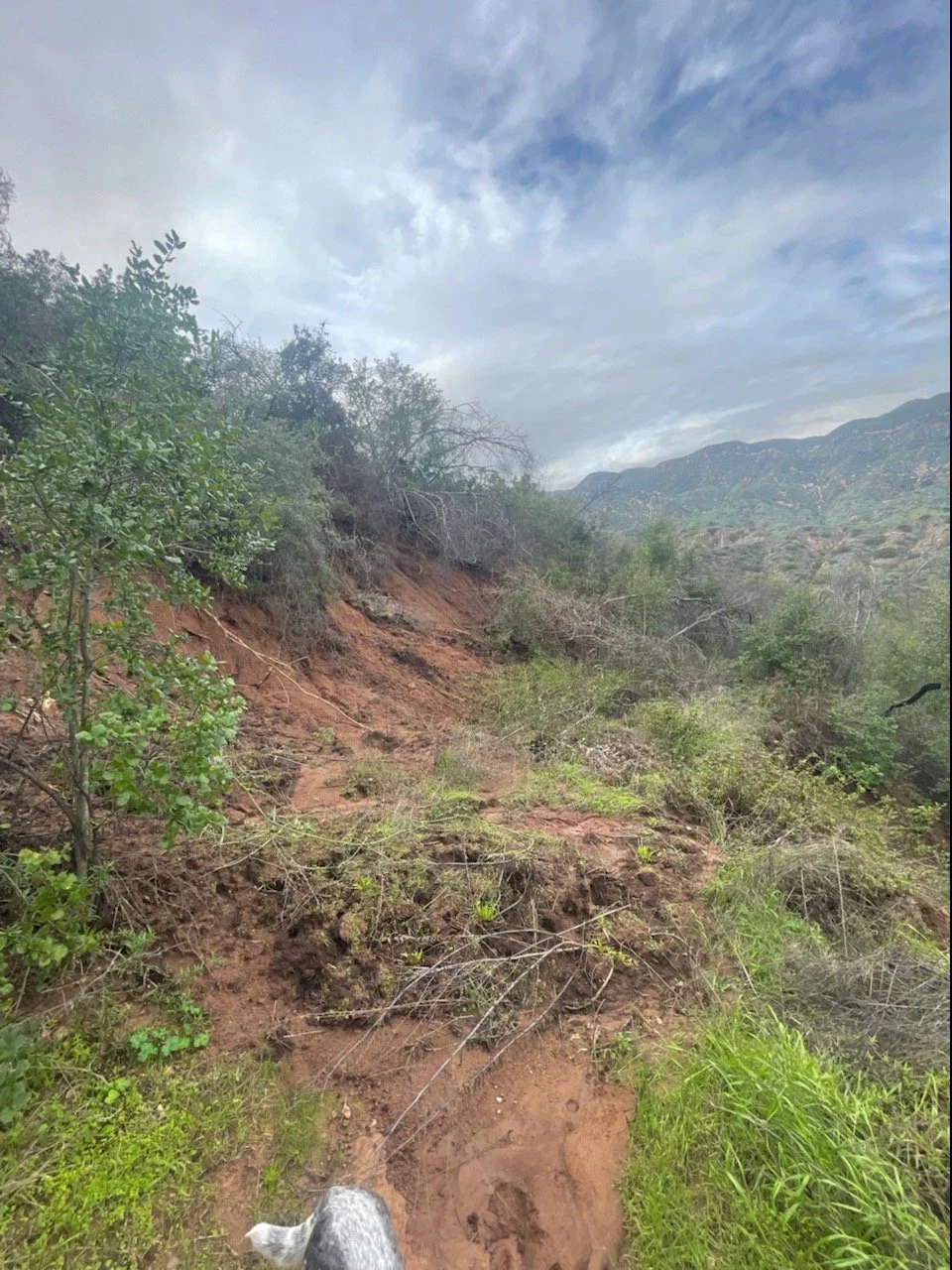
Sections of Oso Ridge will need clearance, but overall this trail did well.

A mudslide and debris cover a section of Oso Ridge Trail
Fern Grotto
Fern Grotto suffered some serious mudslides. This section near the top of the trail is going to need a lot of work before we can reopen it.

Two separate mudslides on Fern Grotto Trail
Orange Grove Trail
In 2013, OVLC rerouted Rice Creek to its natural course after it was cutoff and leveed in the early 1900s when the property was being used for agriculture. After this recent storm, the creek is truly reclaiming its path. There is significant cutting on the Orange Grove Trail where it crosses through Rice Creek. In the third image below, the cobblestone from the french drain we installed at the start of the restoration project was revealed.

Aerial drone imagery of Rice Creek looking north. Courtesy of Wade Sedgwick


Image Left: Waterfall coming off of Orange Grove Trail
Image Right: Where Rice Creek cut through Orange Grove Trail