
Flood Damage Assessment: Valley View Preserve
Report Date: January 18, 2023
Want to know which trails are open? Please visit ovlc.org/trails
The assessment of damages to trails and infrastructure at Valley View Preserve has been completed. The following report provides a brief summary of our reconnaissance.

Please note: Property boundaries are approximate, and the original Foothill Trail still appears on this map.
Each camera icon on the above map of Valley View Preserve indicates either a small slide or some other problem that is directly attributable to the recent rain events. We have documented 21 separate damage sites that need attention. A typical problem at one of these spots is that some portion of the hill above the trail slid and either covered or completely blew out the trail below. In a few other spots, there is essentially a creek running down the center of the trail tread that needs to be diverted with a drainage feature.
Fox Canyon Trail
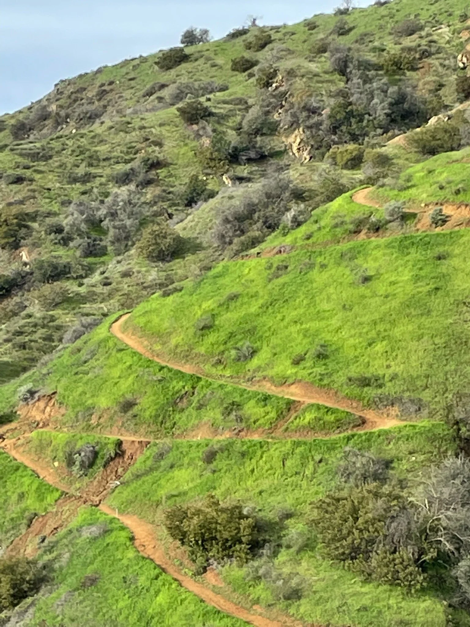
The three images below depict a small sample of the mudslides on Fox Canyon Trail. If you look closely in the first image, you can see the Valley View Preserve kiosk and Shelf Road below. This specific spot, also shown in the second image from a vantage point taken on Luci's Trail, is a significant blowout that is going to require a laborious overhaul to repair. The third image is another slide a couple hundred yards further up Fox Canyon Trail.
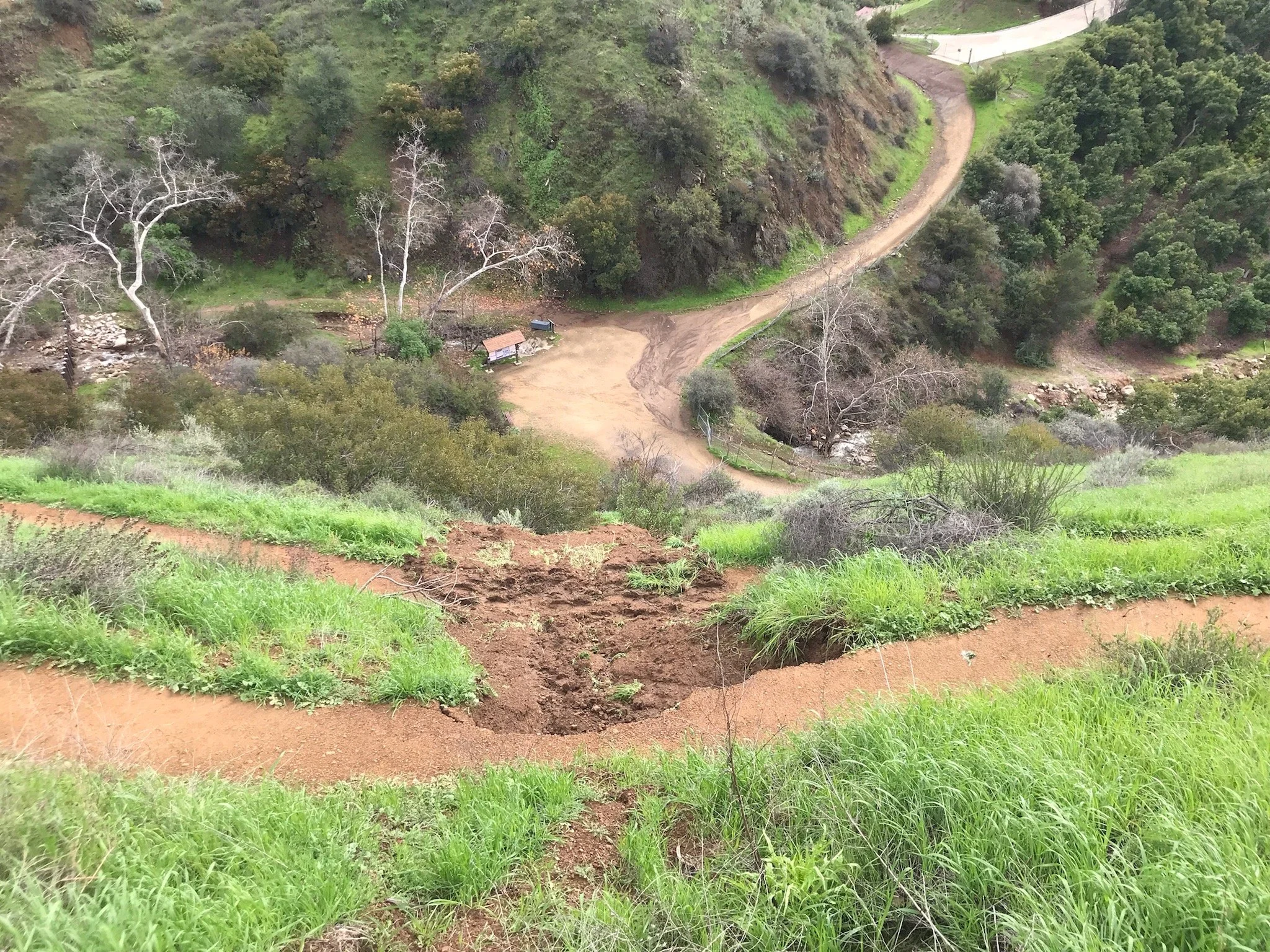
Image 1: The major blowout slide on Fox Canyon Trail as seen from above

While there is much work to be done, the recent storms are also responsible for some beauty. A two-tier waterfall is now flowing in Fox Canyon. This waterfall can be seen from Shelf Road.

Image 4: Two-tier waterfall in Fox Canyon
Luci's Trail
The bottom of Luci's Trail has also taken a significant beating. Pictured below is a significant blowout.


Image 5: One of many major blowouts on Luci's Trail
Where there are volunteers, there is hope!
Our first volunteer crew went out on January 12, 2023 to start chipping away at these problems. However, clearing the vegetation and removing the saturated mud is a slow process. As of 1/18/23, four of the 21 spots identified on the map have been cleared. On the bright side of things, we have tackled two of the worst spots already. We anticipate that we will need five to seven volunteer project days just to clear the rest of the problem areas.
Our goal is to open the trails as soon as possible, and therefore we are focusing on clearing the trails, and not installing drainage features, which is a much more time consuming process. Drainage features, which will be added in the near future, will help protect the trail long-term, and prevent future damage.

Image 9: We are so fortunate to have volunteers working on the trails with us
Currently, the trails at Valley View Preserve are closed and will remain so until we have cleared the slide spots. At a rate of 2-3 volunteer projects per week, we are looking at Valley View trails being closed until the weekend of January 28, at the earliest. Please visit ovlc.org/trails to stay up-to-date on the status of OVLC trails. Thank you for your patience as we work to reopen access to the land you love.
Foothill Reroute
Here's the good news! The new reroute on Foothill Trail, identified by the orange line on the map, held up nicely through the storm (pictured below). We're looking forward to reopening Valley View Preserve as soon as possible so everyone can experience and appreciate the hard work our volunteers have put into constructing the reroute. We know mountain bikers are going to love it. Look at those turns!
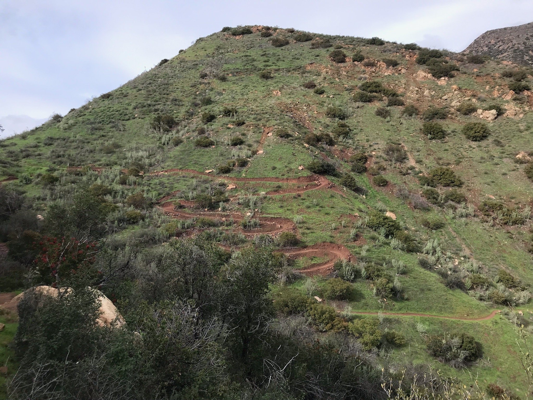
Image 10: The new Foothill reroute held up to the storm
OVLC Adopted Trail Sections on Pratt & Gridley
The Forest Service issued a closure of the entire Los Padres National Forest on January 13, 2023 and the status of the closure will remain in effect until March 14, 2023. We were able to survey the nearby trails we adopted from the Forest Service (Pratt and Gridley) prior to the forest-wide closure, but please remember these trails are now closed to the public. Los Padres National Forest updates can be found here »
We are prioritizing reopening OVLC-owned trails first. Below are three images of conditions on Fuelbreak Road near Gridley. As you can see, the trail is in need of serious repair and debris removal.
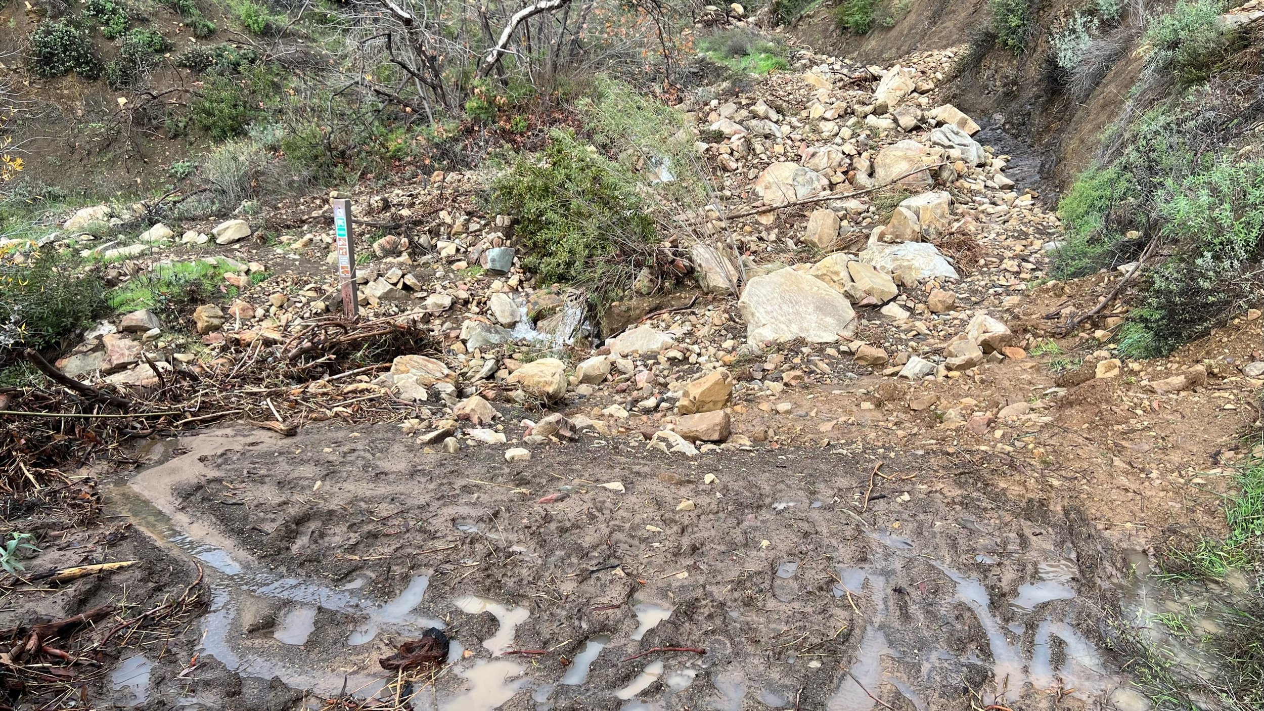
Image 11: Fuelbreak Road after the storms

Image 12: A river transects Fuelbreak Road

Image 13: Fuelbreak Road is covered in debris